

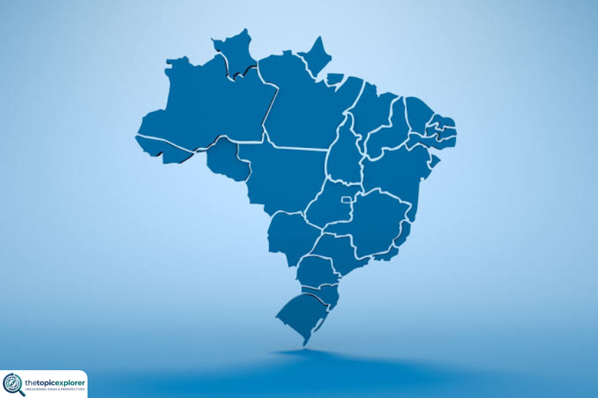

The mapa do brasil is the map of Brazil, showing a country divided into 26 states and one Federal District. These 27 federation units are grouped into five major regions: North, Northeast, Central-West, Southeast, and South. Brasília, located in the Federal District, is the national capital.
However, a Brazil map can show much more than political borders. Depending on the type of map, it can display rivers, relief, biomes, population density, roads, cities, state capitals, international borders, or geographic regions. Therefore, understanding the different versions of the mapa do brasil makes it easier to study the country’s geography and political organization.
For authoritative geography, the best starting point is the IBGE political-administrative division of Brazil. IBGE is Brazil’s official national statistics and geography institute, and its educational resources include political maps, regional maps, state maps, and printable files.
Mapa do Brasil: Quick Answer
A standard mapa do brasil usually displays Brazil’s outer national boundary, the internal borders of the 26 states and the Federal District, and often the location of each state capital.
Brazil’s current federation units are organized into five regions:
- North
- Northeast
- Central-West
- Southeast
- South
The political map is especially useful for students because it shows how the country is administratively divided. Meanwhile, physical and thematic maps answer different questions.
For example, a physical map helps readers understand mountains, plateaus, lowlands, and major rivers. A biome map shows the distribution of large ecological systems such as the Amazon, Cerrado, and Atlantic Forest. A population map, by contrast, helps explain where people are concentrated.
Therefore, the phrase “mapa do brasil” does not refer to only one design. It can describe several maps created for different purposes.
What Does the Mapa do Brasil Show?
The answer depends on the map type.
A basic political map normally shows state borders, abbreviations, capitals, and the Federal District. More detailed political maps may also include major cities, highways, rivers, or neighboring countries.
However, thematic maps focus on a particular subject.
A climate map may divide the country by climate zones. A vegetation or biome map can highlight major ecosystems. A population-density map uses colors or shades to show where more or fewer people live.
Similarly, a hydrographic map emphasizes rivers and drainage basins.
This is why two maps of Brazil can look very different even when both are correct. Each map selects information based on its intended purpose.
For schoolwork, a political map is usually the most familiar version. For environmental studies, however, a biome or relief map may be much more useful.
Political Map of Brazil
The political mapa do brasil shows the country’s official administrative divisions.
According to IBGE, Brazil is divided into 26 states plus the Federal District. Together, these form 27 federation units. The states have their own governments and capitals, while the Federal District contains Brasília and serves as the seat of the federal government.
Political maps use lines to show borders between states. In addition, they often use different colors to make neighboring units easier to identify.
The colors normally do not indicate political parties, wealth, population, or climate. Instead, cartographers generally choose contrasting colors simply to separate adjacent areas visually.
A political map can also show the five major regions. In that case, states belonging to the same region may share the same color family.
Brazil’s 26 States and Federal District
Brazil has 26 states and one Federal District.
The Federal District is not a state. Nevertheless, it is one of Brazil’s 27 federation units and appears alongside the states on national political maps.
Each state uses a two-letter abbreviation. For example, São Paulo uses SP, Bahia uses BA, and Amazonas uses AM.
The abbreviations are especially useful on compact maps because writing every full state name can make the image crowded.
Meanwhile, the Federal District uses DF.
Brazil’s state borders are important for government, elections, statistics, public administration, education, transport planning, and many other activities. Therefore, the political map is more than an educational illustration; it represents the country’s administrative structure.
Mapa do Brasil: States and Capitals
The table below lists all 26 Brazilian states, the Federal District, their abbreviations, capitals, and regions.
| Federation unit | Abbreviation | Capital | Region |
|---|---|---|---|
| Acre | AC | Rio Branco | North |
| Alagoas | AL | Maceió | Northeast |
| Amapá | AP | Macapá | North |
| Amazonas | AM | Manaus | North |
| Bahia | BA | Salvador | Northeast |
| Ceará | CE | Fortaleza | Northeast |
| Distrito Federal | DF | Brasília | Central-West |
| Espírito Santo | ES | Vitória | Southeast |
| Goiás | GO | Goiânia | Central-West |
| Maranhão | MA | São Luís | Northeast |
| Mato Grosso | MT | Cuiabá | Central-West |
| Mato Grosso do Sul | MS | Campo Grande | Central-West |
| Minas Gerais | MG | Belo Horizonte | Southeast |
| Pará | PA | Belém | North |
| Paraíba | PB | João Pessoa | Northeast |
| Paraná | PR | Curitiba | South |
| Pernambuco | PE | Recife | Northeast |
| Piauí | PI | Teresina | Northeast |
| Rio de Janeiro | RJ | Rio de Janeiro | Southeast |
| Rio Grande do Norte | RN | Natal | Northeast |
| Rio Grande do Sul | RS | Porto Alegre | South |
| Rondônia | RO | Porto Velho | North |
| Roraima | RR | Boa Vista | North |
| Santa Catarina | SC | Florianópolis | South |
| São Paulo | SP | São Paulo | Southeast |
| Sergipe | SE | Aracaju | Northeast |
| Tocantins | TO | Palmas | North |
This state-and-capital structure is one of the most useful ways to study a mapa do brasil.
Mapa do Brasil by Five Regions
IBGE groups Brazil into five Major Regions. These regional divisions help organize statistics and make it easier to compare parts of such a large country.
The five regions do not replace states. Instead, they group neighboring federation units.
The IBGE regional division resources provide official geographic material for understanding these divisions.
Each region has a different number of states, physical landscapes, economic patterns, settlement histories, and population distributions.
Mapa do Brasil: North Region
The North is the largest Brazilian region by area.
It contains seven states:
- Acre
- Amapá
- Amazonas
- Pará
- Rondônia
- Roraima
- Tocantins
Much of the Amazon rainforest lies within this region. Moreover, several of Brazil’s largest rivers and vast areas with relatively low population density appear here.
Manaus and Belém are among the region’s best-known major cities.
On many regional maps, the North occupies an enormous share of the country’s upper and western territory.
Mapa do Brasil: Northeast Region
The Northeast contains nine states, more than any other Brazilian region:
- Alagoas
- Bahia
- Ceará
- Maranhão
- Paraíba
- Pernambuco
- Piauí
- Rio Grande do Norte
- Sergipe
The region has a long Atlantic coastline and includes landscapes ranging from humid coastal zones to the drier interior.
Cities such as Salvador, Recife, and Fortaleza are major regional centers.
Because nine states occupy the Northeast, their labels can appear relatively close together on small maps. Therefore, high-resolution maps are often easier to read.
Central-West Region
The Central-West contains Goiás, Mato Grosso, Mato Grosso do Sul, and the Federal District.
Brasília is located in the Federal District.
The region occupies a large central part of the national territory and includes major areas of the Cerrado as well as part of the Pantanal.
Because Brasília is the federal capital, the Central-West has major political importance even though Brazil’s largest metropolitan populations are concentrated elsewhere.
Mapa do Brasil: Southeast Region
The Southeast includes four states:
- Espírito Santo
- Minas Gerais
- Rio de Janeiro
- São Paulo
Although it has fewer states than the Northeast or North, the Southeast contains some of Brazil’s largest urban and economic centers.
São Paulo and Rio de Janeiro are especially prominent on maps showing population, transport, business activity, or major cities.
Meanwhile, Minas Gerais occupies a large inland area, while Espírito Santo has an Atlantic coastline.
South Region
The South contains three states:
- Paraná
- Santa Catarina
- Rio Grande do Sul
It is the smallest of the five major regions by territorial area.
Nevertheless, it contains several important metropolitan, agricultural, industrial, and port areas.
On a national map, the South appears at the bottom of Brazil, bordering Argentina, Paraguay, and Uruguay.
Where Is Brazil on the Map?
Brazil occupies a large portion of eastern and central South America.
The Atlantic Ocean lies along its eastern coast. Meanwhile, Brazil extends deep into the continent toward the west and north.
Its size explains why a continental map of South America is useful alongside a state-level mapa do brasil.
Brazil is geographically connected to most of South America through land borders.
It shares boundaries with Argentina, Bolivia, Colombia, Guyana, Paraguay, Peru, Suriname, Uruguay, Venezuela, and the French overseas territory of French Guiana.
However, it does not share a land border with Chile or Ecuador.
This position gives Brazil one of the continent’s most extensive sets of international frontiers.
Mapa do Brasil and International Borders
An international-border map helps explain Brazil’s relationship with the rest of South America.
The country’s border system is especially long because of its continental scale.
To the north, Brazil borders Venezuela, Guyana, Suriname, and French Guiana. To the west, its neighbors include Colombia, Peru, and Bolivia. Farther south and southwest are Paraguay, Argentina, and Uruguay.
Meanwhile, the Atlantic Ocean defines the country’s eastern maritime side.
A border map is useful for studying trade routes, migration, ecosystems, international rivers, security, and regional integration.
Moreover, many ecological systems cross political borders. The Amazon, for example, extends beyond Brazil into neighboring countries. Therefore, a political border is not always an environmental boundary.
Mapa do Brasil Physical Map
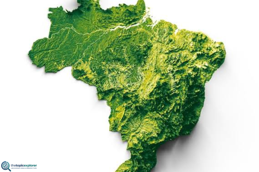
A physical mapa do brasil focuses on natural landforms rather than state governments.
It may show:
- elevation;
- plateaus;
- plains;
- depressions;
- mountain ranges;
- major rivers;
- coastline features.
IBGE provides an official physical map among its downloadable educational map resources. Readers can access political, physical, border, regional, and state maps through the IBGE map download collection.
Physical maps often use color gradients.
For example, higher elevations may appear in darker or warmer colors, while lower areas may use greens. Water features usually appear in blue.
However, users should always check the legend because color conventions can vary.
Understanding Brazil’s Relief and Landscape
Brazil does not have the extremely high mountain chains found along the western edge of South America.
Instead, much of the country consists of plateaus, depressions, and plains.
This relief has influenced river systems, settlement, agriculture, transport, and land use.
For example, lowland areas are important in the Amazon Basin, while plateaus cover large areas elsewhere.
A relief map also helps students understand why rivers flow in particular directions.
Moreover, combining a relief map with a political map can reveal how natural features cross state boundaries.
This is an important geographic lesson: political divisions are created by people, while rivers, ecosystems, and landforms often extend across several administrative units.
Mapa do Brasil Biome Map
A biome mapa do brasil shows the country’s major ecological regions.
Brazil is commonly divided into six major terrestrial biomes:
- Amazon
- Cerrado
- Atlantic Forest
- Caatinga
- Pantanal
- Pampa
Each biome has a distinctive combination of vegetation, climate, soils, wildlife, and ecological processes.
The Amazon covers a vast northern area. The Cerrado occupies much of central Brazil. The Caatinga is strongly associated with the semi-arid Northeast. The Atlantic Forest follows much of the eastern and southeastern side of the country, although its original cover has been greatly reduced.
Meanwhile, the Pantanal is concentrated mainly in the Central-West, and the Pampa is associated with the far south.
A biome map is especially useful when studying conservation and biodiversity.
Population Map and Density Patterns
A population map shows where Brazilians live rather than merely where state borders are located.
Some maps display total population by state. Others show population density, which measures the number of residents relative to land area.
These two map types can tell different stories.
A very large state may have millions of residents but still show a low population density because its territory is enormous.
By contrast, a smaller urbanized state can show a much higher density.
Population maps also make Brazil’s settlement pattern easier to understand. Large concentrations appear around major urban and coastal areas, especially in the Southeast and parts of the South and Northeast.
Therefore, population maps add a human-geography layer that a basic political map cannot show.
Mapa do Brasil Hydrographic Map
A hydrographic mapa do brasil focuses on rivers, drainage systems, and basins.
Brazil has some of the world’s most extensive river networks. The Amazon River system is the most globally famous, but the country also includes many other major basins and rivers.
Hydrographic maps help explain:
- water supply;
- navigation;
- hydroelectric generation;
- ecosystems;
- agriculture;
- flood patterns;
- regional settlement.
In addition, river systems often cross state and international borders.
Therefore, these maps are useful for seeing the country as an interconnected physical system rather than as 27 separate federation units.
Students can compare a hydrographic map with a political map to see which rivers form borders and which flow across multiple states.
Blank and Printable Maps of Brazil
Blank maps are especially useful for school activities.
A blank outline can be used to:
- write state names;
- add abbreviations;
- mark capitals;
- color the five regions;
- identify neighboring countries;
- practice geography from memory.
Some blank maps include state boundaries but no labels. Others remove internal borders as well.
For younger students, a state-outline map is often more practical because it gives enough structure to identify each federation unit.
For more advanced exercises, teachers may use an unlabeled regional or physical map.
However, users should prefer maps from reliable educational or official sources when accuracy matters.
Mapa do Brasil Official IBGE Downloads
The best place to download an authoritative mapa do brasil is IBGE.
The official IBGE map resource page provides maps for consultation, download, and printing.
Available categories include:
- political map of Brazil;
- physical map of Brazil;
- extreme points and borders;
- maps of the five major regions;
- individual state maps.
This makes the IBGE collection particularly valuable for teachers, students, researchers, and publishers.
In addition, the IBGE National Atlas of Brazil provides broader cartographic context and historical material about how Brazil has been represented geographically.
For educational accuracy, official IBGE files should generally be preferred over random image-search results.
How to Read the Mapa do Brasil
Reading a map requires more than recognizing the country’s outline.
Start with the title. It tells you what kind of information the map intends to show.
Next, check the legend. The legend explains what colors, lines, symbols, and shading mean.
Then, look at the scale. Scale indicates how distances on the map relate to real-world distances.
A compass or north arrow can help with orientation.
Finally, examine the source and date.
The date matters because political boundaries, municipality counts, roads, and statistical information can change. A map showing population density from an older census, for example, should not be treated as current population data.
Therefore, map literacy includes checking both design and context.
Why Map Colors Can Differ
Two accurate maps of Brazil can use completely different colors.
Political maps often assign contrasting colors to states so adjoining units are easy to distinguish.
Regional maps may instead use one color for all states in the same region.
Physical maps use colors to represent elevation or landforms.
Population maps may use darker shades for more populated or denser areas.
Biome maps usually assign a separate color to each biome.
Therefore, colors do not have one universal meaning.
Always read the legend before interpreting them. A green state on one map may mean “North Region,” while green on another map may represent low elevation, forest cover, or a statistical category.
Mapa do Brasil Through History
The mapa do brasil has changed significantly over time.
Early European maps focused heavily on the Atlantic coastline because inland areas were less known to European cartographers.
As colonial expansion continued, maps became more detailed and began representing rivers, settlements, routes, and disputed territorial claims.
Later, the internal political map changed as provinces, states, territories, and administrative divisions were reorganized.
The modern five-region model also developed through IBGE’s evolving regional classifications.
One major recent political change was the creation of Tocantins from the northern portion of Goiás in connection with the 1988 constitutional reorganization.
The current map therefore reflects centuries of territorial expansion, political change, surveying, and cartographic improvement.
How Brazil’s Current Map Helps Students
A modern political map gives students a visual framework for understanding Brazil.
Instead of memorizing isolated names, learners can see how states relate spatially.
For example, they can see that Amazonas is in the North, Bahia is in the Northeast, São Paulo is in the Southeast, and Rio Grande do Sul is at the southern end of the country.
Students can also connect capitals to state locations.
Moreover, comparing political, biome, physical, and population maps teaches an important geographic skill: one place can be represented in several ways depending on the question being asked.
Therefore, maps are not simply illustrations. They are tools for organizing geographic information.
Mapa do Brasil for Travel Planning
A mapa do brasil can also be useful for travelers.
A national map helps visitors understand the enormous distances between destinations.
For example, visiting Rio de Janeiro, Brasília, Manaus, Salvador, and Foz do Iguaçu involves travel across very different parts of the country.
A state map can then provide more detail once the traveler chooses a region.
Road maps are useful for driving routes, while physical maps help explain terrain.
Meanwhile, city maps provide street-level information that a national political map cannot offer.
Therefore, travelers should choose map scale according to the task. A national map is excellent for orientation, but it is not detailed enough for local navigation.
Frequently Asked Questions About Mapa do Brasil
1. What Is Mapa do Brasil?
Mapa do brasil means “map of Brazil” in Portuguese.
It can refer to a political map showing states and capitals or to a thematic map showing physical geography, biomes, rivers, population, roads, or other information.
The political version is the most common in schools.
2. How Many States Appear on Mapa do Brasil?
Brazil has 26 states.
In addition, the political map includes the Federal District, making a total of 27 federation units.
The Federal District contains Brasília and should not be counted as a 27th state.
3. What Are the Five Regions on Mapa do Brasil?
The five Major Regions are North, Northeast, Central-West, Southeast, and South.
IBGE uses these regions to organize geographic and statistical information.
Each region contains several states, while the Federal District belongs to the Central-West.
4. What Is the Capital Shown on Mapa do Brasil?
Brazil’s national capital is Brasília.
Brasília is located in the Federal District in the Central-West Region.
It became the national capital in 1960, replacing Rio de Janeiro.
5. Which Is the Largest State on Mapa do Brasil?
Amazonas is Brazil’s largest state by territorial area.
It occupies a vast part of the North Region and contains extensive areas of the Amazon rainforest.
Because of its size, Amazonas is visually one of the most prominent states on a political map.
6. Where Can I Download an Official Mapa do Brasil?
IBGE provides official maps for viewing, downloading, and printing.
Its map collection includes political, physical, regional, border, and state maps.
Therefore, IBGE is one of the most reliable sources for an accurate downloadable Brazil map.
7. Can I Find a Blank Mapa do Brasil for School?
Yes.
Blank maps are commonly available with state borders but without labels, allowing students to write state names, abbreviations, capitals, or regional colors.
For accuracy, official or reputable educational map sources are preferable.
8. Which Countries Border Brazil?
Brazil borders Argentina, Bolivia, Colombia, Guyana, Paraguay, Peru, Suriname, Uruguay, Venezuela, and French Guiana.
It does not border Chile or Ecuador.
The Atlantic Ocean lies to the east.
9. What Is the Difference Between Political and Physical Brazil Maps?
A political map emphasizes human administrative divisions such as states, borders, capitals, and cities.
A physical map emphasizes natural features such as elevation, landforms, rivers, and terrain.
Therefore, each map answers a different geographic question.
10. Why Do Mapa do Brasil Images Use Different Colors?
Map colors depend on purpose.
Political maps may color neighboring states differently. Regional maps may use a single color for each of the five regions. Physical maps use colors for elevation, while thematic maps may use shades for population or other data.
Always check the legend before interpreting colors.
Conclusion: Using the Mapa do Brasil
The mapa do brasil is much more than the familiar outline of South America’s largest country.
A political version shows 26 states and the Federal District. A regional map groups those federation units into North, Northeast, Central-West, Southeast, and South. Meanwhile, physical, biome, population, and hydrographic maps reveal different layers of Brazil’s geography.
For students, the most useful starting point is often the state-and-capital map. From there, regional and thematic maps make it easier to understand how people, ecosystems, rivers, cities, and landforms are distributed across the country.
Most importantly, use a reliable source.
IBGE produces official Brazilian geographic material and makes political, physical, regional, border, and state maps available for consultation and download. For broader background on the regional system, the Regions of Brazil page on Wikipedia can also provide useful contextual reading.
Whether the goal is schoolwork, travel planning, geographic research, or simple curiosity, the right mapa do brasil turns a huge territory into information that is much easier to understand.
